


GIS Support for the 2016 MSF Yellow Fever Vaccination Campaign in Kinshasa
Médecins Sans Frontières (MSF)
"Based on the interviews, it is possible to conclude that GIS support was a very important enabler - although not a critical factor - in the vaccination campaign. GIS support allowed MSF staff to complete their work more quickly, more safely and more accurately."
Over a period of 10 days in August 2016, Médecins Sans Frontières (MSF) staff vaccinated more than 710,000 people against yellow fever and advised them how they could help prevent its spread in Kinshasa, the capital of the Democratic Republic of the Congo. This case study explores the role that the work of a geographic information systems (GIS) officer played in the success of the vaccination campaign in a place where street maps and data on how many people are living in different parts of the city had been inadequate or nonexistent. In this case study, the term 'GIS' encompasses any use of maps, ranging from the basic use of maps in the field to the use of Global Positioning System (GPS), remote sensing (satellite imagery), and all kinds of geo-referenced information (locations of patients, infrastructure etc.).
During his deployment in DRC from July 26 to September 15 2016, the GIS officer produced a total of 240 different GIS products (see Chapter 4 of the report). His activities ranged from collecting GPS points to producing bespoke maps for different technical units, and from improving a critical database to developing sampling methodologies. The 11 MSF staff interviewed for this case study agreed that the most useful maps he created were those that helped them navigate safely and quickly through Kinshasa's narrow streets and showed where locations were in relation to each other. In addition to road maps and maps displaying buildings, this included access maps that showed which streets could be used by vehicles and which could only be navigated on foot.
Aside from the navigational maps, MSF staff said they appreciated visualisations that showed the daily progress of the campaign in the different locations. These visualisations helped them quickly identify and address gaps at specific vaccination centres and allocate resources in the most efficient way. GIS support made it possible to investigate and immediately address issues that might otherwise have remained undiscovered until a post-vaccination evaluation. MapKits are an example of good practice that the GIS specialist has continued to roll out after positive experiences in previous deployments. MapKits are ready-to-use sets of A3 maps, which were given to all staff who had a supervisory role. These kits included the most common maps (such as road maps) and were updated with the most recent specialised maps for logistics, epidemiology, etc. Teams could pick these maps up as needed, without the GIS specialist needing to be present.
The interviewees described the information and communication technology (ICT) infrastructure as adequate. Given that the vaccination campaign took place in the capital, Kinshasa, and that the vaccination campaign team was housed close to the international airport, mobile 3G Internet service was readily available and sufficient. Later, a very small aperture terminal (VSAT) setup further increased the available bandwidth at base.
However, the evaluation found that the GIS specialist workload reached a critical level during some parts of the deployment. GIS support relying on a unique GIS specialist showed some limitations, especially over nights when the GIS specialist was only able to produce maps based on data available when teams returned from the field. This indicates a need for improvement regarding how GIS is integrated into the overall flow of information during an operation to ensure that GIS specialists get data sooner. In addition, several interviewees said it was important for a GIS specialist to listen to the needs of programme staff and suggest solutions, rather than to expect programme staff to be able to request products that meet their needs. (Since many programme staff do not have enough GIS knowledge to ask for specific products, it is essential that the GIS specialist is able to translate the needs into product recommendations.)
The case study concludes with a series of recommendations. For example, in cases where digital volunteers (for example, via Missing Maps) support the field teams: continue to communicate the impact of their support to these volunteers via short, lightweight messages (such as photos, short message service (SMS)/text messages, or tweets). Clearly, this can only be done in situations where there are no confidentiality issues and should also involve MSF's field-based communications officers.
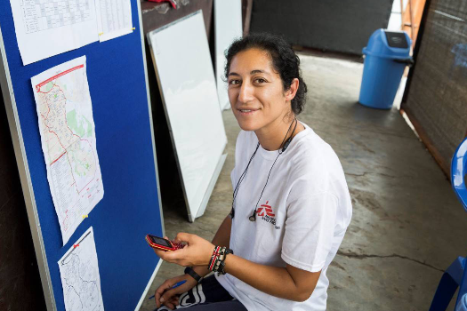
"How maps helped MSF vaccinate 700,000 people in 10 days", by Timo Lüge, Social Media for Good, October 23 2017. Image caption/credit: Nadia Ben Helal, a logistics team leader, checks a map. Photo: Dieter Telemans
- Log in to post comments