


Using GIS as a Planning and Coordination Tool in Refugee Camps in South Sudan
REACH
"The database and maps (both static and interactive) make household-level data readily available for customised geospatial analyses and for informing aid planning and response."
Humanitarian assistance in emergencies depends on an immediate supply of data. Global Shelter Cluster (GSC), including, among others, the International Federation of Red Cross and Red Crescent Societies (IFRC), and the United Nations Refugee Agency (UNHCR), developed a methodology aimed at bringing together data from reliable sources and representing it in both text and geospatial formats, such as static and interactive webmaps. From its outset, REACH has been an interagency initiative between international non-governmental organisations (INGOs) and UN programmes, its founding members being ACTED, IMPACT Initiatives, and UNOSAT (The United Nations Institute for Training and Research (UNITAR) Operational Satellite Applications Programme).
"The methodology used by REACH combines a household-level unique identifier - or number that is assigned by UNHCR to each individual refugee household - with information on social group membership of each household and a geo-referencing of each household’s shelter or tent. This is achieved in three steps.
First, by identifying a standard, common and unique UNHCR field of data - a ration card or registration number - that all refugee households receive, information from previously disparate sources can be linked in a simple database. Data on the demographics of each refugee household (from the UNHCR database), the physical location of that household (by GPS point) and its social profile (from REACH mapping assessments) are placed side by side in a database, allowing for queries between these fields.
The second step of the methodology involves strong interagency cooperation and input. Each agency has a well-defined role in the camp linked to sectoral responsibility (for example medical relief, water delivery and food distribution). The methodology capitalises on that specialisation by forming partnerships and agreements with other agencies for regular data delivery on sector-specific aid provision in a standardised format. By linking this data with the household-level unique identifier in the database, it can then be associated with the demographic, social and geographic data mentioned above. With this information, highly complex queries can be made from many different fields of data.
The third step applies spatial representation to the collected data, which has now been linked in the database. The database serves as the backbone of an interactive map that displays each asset and refugee household in the camp, overlaying high-resolution satellite imagery provided by UNOSAT. The map is then updated with additional information from assessments and other data fields collected by aid agencies, providing geo-referenced aid provision and planning data at the press of a button. Aid actors are able to track aid provision throughout the camp, while also creating custom-made, tailored analyses that drastically improve planning and coordination. In addition, the data is used to produce static maps as requested."
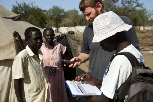
Examples of REACH coordination are available from the refugee crisis in South Sudan in 2012. REACH staff received the regularly updated sectoral information from the humanitarian NGOs working with UNHCR and gathered geographic data. The REACH outputs were fact sheets and analysis reports, static maps, and interactive CD-ROM and web-based maps available to those involved with crisis intervention. Thus, household-level data was available for customised geospatial analyses and for informing aid planning and response. Illustrations of the outputs include maps of Jaman refugee camp supporting water provision, sanitation, community mobilisation, medical care, and aid tracking. Water distribution maps show population concentrations and distances from current water supplies to aid in planning new tap sites, as well as new pipeline construction. The information allowed for: the reorganisation of the camp by place and tribe of origin, enhancing community mobilisation and representation in the camp; planning a cholera vaccination campaign; random sampling of households for a Centers for Disease Control and Prevention (CDC) survey; improving the accountability of aid by enhancing its traceability down to the household level; and locating individuals with specific needs to facilitate follow-up care.
Challenges include the need to update information frequently due to constant refugee population movement, the limited internet access and low bandwidth, and database compatibility among agencies. Regular meetings with aid agencies are held to point out the importance of data formatting for standardisation. In addition, field teams establish a close relationship with the community liaison and mobilisation teams in order to monitor changes within refugee environments.
The REACH methodology is being adapted and tested for working with Syrian refugees in the 2013 Syrian crisis.
Emails from Clay Westrope and Kathrin Bolz to The Communication Initiative on July 24 2013 and September 14 2015. Image credit: © Gwenn Dourthoumieu/ACTED
- Log in to post comments